
Thank you for supporting this site ❤️
Make a donation
Make a donation
Frankville topographic map
Click on the map to display elevation.
Thank you for supporting this site ❤️
Make a donation
Make a donation
About this map
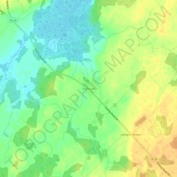
Name: Frankville topographic map, elevation, terrain.
Average elevation: 118 m
Minimum elevation: 102 m
Maximum elevation: 135 m
Thank you for supporting this site ❤️
Make a donation
Make a donation
Other topographic maps
Click on a map to view its topography, its elevation and its terrain.
Elizabethtown
Canada > Ontario > Leeds and Grenville Counties > Elizabethtown-Kitley
Average elevation: 110 m