
Make a donation
Karachi Division topographic map
Click on the map to display elevation.
Make a donation
Karachi Division
Karachi lies very close to a major fault line, where the Indian tectonic plate meets the Arabian tectonic plate. However, Karachi lies near the western edge of the Indian Plate, on the Indo Gagnetic Plain. Within the city of Karachi are two small ranges: the Khasa Hills and Mulri Hills, which lie in the northwest and act as a barrier between North Nazimabad and Orangi. Karachi's hills are barren and are part of the larger Kirthar Range, and have a maximum elevation of 528 metres (1,732 feet).
Make a donation
About this map
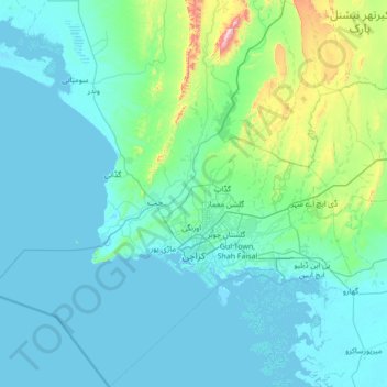
Name: Karachi Division topographic map, elevation, terrain.
Location: Karachi Division, Sindh, Pakistan (24.42735 66.28623 25.67680 67.58278)
Average elevation: 89 m
Minimum elevation: -2 m
Maximum elevation: 1,065 m
Make a donation
Other topographic maps
Click on a map to view its topography, its elevation and its terrain.