
Gemeinde Sulz topographic map
Interactive map
Click on the map to display elevation.
About this map
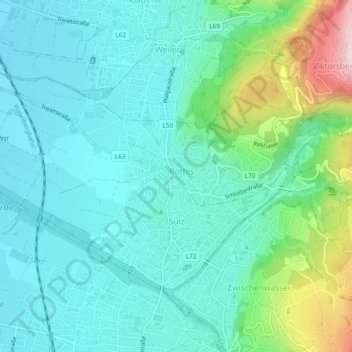
Name: Gemeinde Sulz topographic map, elevation, terrain.
Location: Gemeinde Sulz, Bezirk Feldkirch, Vorarlberg, 6832, Autriche (47.28144 9.62077 47.30204 9.66786)
Average elevation: 530 m
Minimum elevation: 442 m
Maximum elevation: 852 m