
Allier topographic map
Interactive map
Click on the map to display elevation.
About this map
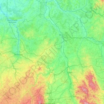
Name: Allier topographic map, elevation, terrain.
Location: Allier, Auvergne-Rhône-Alpes, Francia metropolitana, Francia (45.93071 2.27684 46.80415 4.00558)
Average elevation: 373 m
Minimum elevation: 133 m
Maximum elevation: 1,437 m
Other topographic maps
Click on a map to view its topography, its elevation and its terrain.
Bègues
Francia > Auvergne-Rhône-Alpes > Allier
Bègues, Vichy, Allier, Auvergne-Rhône-Alpes, Francia metropolitana, 03800, Francia
Average elevation: 415 m