
Make a donation
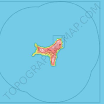
Christmas Island topographic map
Click on the map to display elevation.
Make a donation
Christmas Island
The island is about 19 kilometres (12 mi) in greatest length and 14.5 km (9.0 mi) in breadth. The total land area is 135 square kilometres (52 sq mi), with 138.9 km (86.3 mi) of coastline. Steep cliffs along much of the coast rise abruptly to a central plateau. Elevation ranges from sea level to 361 m (1,184 ft) at Murray Hill. The island is mainly tropical rainforest, 63% of which is national parkland. The narrow fringing reef surrounding the island poses a maritime hazard.
Make a donation
About this map
Name: Christmas Island topographic map, elevation, terrain.
Location: Christmas Island, Australia (-10.77141 105.33015 -10.21148 105.91580)
Average elevation: 7 m
Minimum elevation: 0 m
Maximum elevation: 355 m
Make a donation
Other topographic maps
Click on a map to view its topography, its elevation and its terrain.
Make a donation
Make a donation
Make a donation
Make a donation
Cairns
South of Smithfield and inland from the Northern Beaches along the edge of the Barron River flood plain are the suburbs of Caravonica, Kamerunga, Freshwater, and Stratford. This area is sometimes referred to as Freshwater Valley, though it is actually the lower part of Redlynch Valley; further up the valley…
Average elevation: 176 m
Make a donation
Make a donation