
Cameron topographic map
Interactive map
Click on the map to display elevation.
About this map
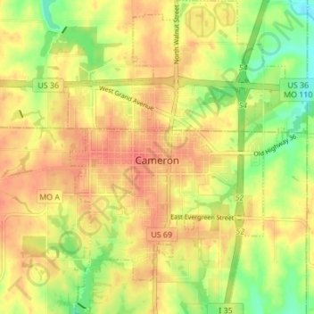
Name: Cameron topographic map, elevation, terrain.
Location: Cameron, Clinton County, Missouri, 64429, United States (39.71550 -94.26010 39.76794 -94.20521)
Average elevation: 301 m
Minimum elevation: 272 m
Maximum elevation: 320 m
Other topographic maps
Click on a map to view its topography, its elevation and its terrain.
Brushy Creek
United States > Missouri > Clinton County
Brushy Creek, Clinton County, Missouri, 64429, United States
Average elevation: 274 m