
Thank you for supporting this site ❤️
Make a donation
Make a donation
Pimentel topographic map
Click on the map to display elevation.
Thank you for supporting this site ❤️
Make a donation
Make a donation
About this map
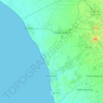
Name: Pimentel topographic map, elevation, terrain.
Location: Pimentel, Chiclayo, Lambayeque, Perú (-6.87362 -79.94289 -6.72805 -79.85479)
Average elevation: 9 m
Minimum elevation: 0 m
Maximum elevation: 61 m
Thank you for supporting this site ❤️
Make a donation
Make a donation
Other topographic maps
Click on a map to view its topography, its elevation and its terrain.