
Grasberg topographic map
Interactive map
Click on the map to display elevation.
About this map
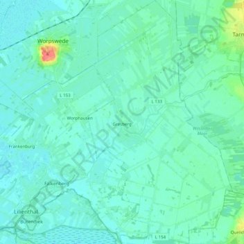
Name: Grasberg topographic map, elevation, terrain.
Location: Grasberg, Landkreis Osterholz, Niedersachsen, 28879, Deutschland (53.12596 8.95577 53.24226 9.07135)
Average elevation: 7 m
Minimum elevation: 0 m
Maximum elevation: 51 m
Other topographic maps
Click on a map to view its topography, its elevation and its terrain.
Vollersode
Deutschland > Niedersachsen > Landkreis Osterholz
Vollersode, Samtgemeinde Hambergen, Landkreis Osterholz, Niedersachsen, Deutschland
Average elevation: 11 m