
Thank you for supporting this site ❤️
Make a donation
Make a donation
Semonkong topographic map
Click on the map to display elevation.
Thank you for supporting this site ❤️
Make a donation
Make a donation
About this map
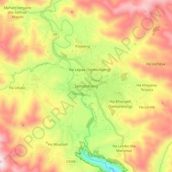
Name: Semonkong topographic map, elevation, terrain.
Location: Semonkong, Maseru District, Lesotho (-29.88001 28.01110 -29.80001 28.09110)
Average elevation: 2,335 m
Minimum elevation: 1,849 m
Maximum elevation: 2,761 m
Thank you for supporting this site ❤️
Make a donation
Make a donation
Other topographic maps
Click on a map to view its topography, its elevation and its terrain.