
Andover topographic map
Click on the map to display elevation.
About this map
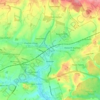
Name: Andover topographic map, elevation, terrain.
Location: Andover, Test Valley, Hampshire, England, United Kingdom (51.19455 -1.53440 51.23710 -1.42111)
Average elevation: 90 m
Minimum elevation: 48 m
Maximum elevation: 151 m
Other topographic maps
Click on a map to view its topography, its elevation and its terrain.