
Thank you for supporting this site ❤️
Make a donation
Make a donation
La Motte topographic map
Click on the map to display elevation.
Thank you for supporting this site ❤️
Make a donation
Make a donation
About this map
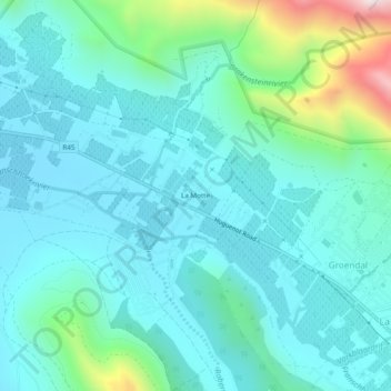
Name: La Motte topographic map, elevation, terrain.
Average elevation: 315 m
Minimum elevation: 183 m
Maximum elevation: 916 m
Thank you for supporting this site ❤️
Make a donation
Make a donation
Other topographic maps
Click on a map to view its topography, its elevation and its terrain.
Eerste River
South Africa > Western Cape > Cape Winelands District Municipality > Stellenbosch Local Municipality
Average elevation: 379 m