
Thank you for supporting this site ❤️
Make a donation
Make a donation
Kromme Rijn topographic map
Click on the map to display elevation.
Thank you for supporting this site ❤️
Make a donation
Make a donation
About this map
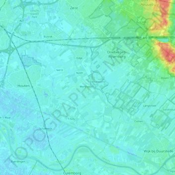
Name: Kromme Rijn topographic map, elevation, terrain.
Location: Kromme Rijn, Utrecht, Netherlands (51.96965 5.12525 52.08137 5.35247)
Average elevation: 6 m
Minimum elevation: -3 m
Maximum elevation: 52 m
Thank you for supporting this site ❤️
Make a donation
Make a donation