
Nqabara topographic map
Interactive map
Click on the map to display elevation.
About this map
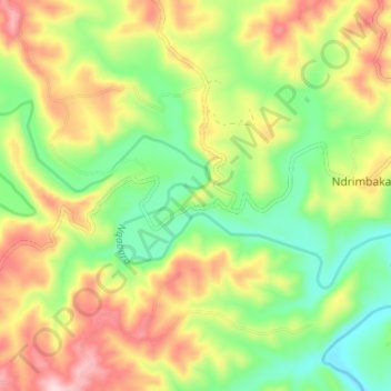
Name: Nqabara topographic map, elevation, terrain.
Average elevation: 238 m
Minimum elevation: 114 m
Maximum elevation: 400 m
Other topographic maps
Click on a map to view its topography, its elevation and its terrain.
Xora
RSA > Eastern Cape > Mbhashe Local Municipality
Xora, Mbhashe Local Municipality, Amathole District Municipality, Eastern Cape, RSA
Average elevation: 324 m