
Tierrantona topographic map
Interactive map
Click on the map to display elevation.
About this map
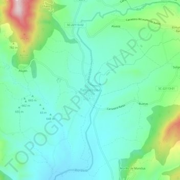
Name: Tierrantona topographic map, elevation, terrain.
Location: Tierrantona, La Fueva, Sobrarbe, Huesca, Aragon, 22336, Espagne (42.35088 0.25181 42.39088 0.29181)
Average elevation: 685 m
Minimum elevation: 590 m
Maximum elevation: 976 m
Other topographic maps
Click on a map to view its topography, its elevation and its terrain.
Morillo de Monclus
Espagne > Aragon > Sobrarbe > La Fueva
Morillo de Monclus, La Fueva, Sobrarbe, Huesca, Aragon, 22336, Espagne
Average elevation: 698 m