
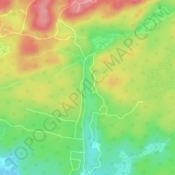
Lac Crooks topographic map
Interactive map
Click on the map to display elevation.
About this map
Name: Lac Crooks topographic map, elevation, terrain.
Average elevation: 205 m
Minimum elevation: 154 m
Maximum elevation: 260 m
Other topographic maps
Click on a map to view its topography, its elevation and its terrain.
Lac Carillon
Canada > Québec > Brownsburg-Chatham
Lac Carillon, Rue du Progrès, Brownsburg-Chatham, Argenteuil, Laurentides, Québec, J8G 3C4, Canada
Average elevation: 185 m
Dunany
Canada > Québec > Brownsburg-Chatham
Dunany, Brownsburg-Chatham, Argenteuil, Laurentides, Québec, Canada
Average elevation: 256 m
Cushing
Canada > Québec > Brownsburg-Chatham > Cushing
Cushing, Brownsburg-Chatham, Argenteuil, Laurentides, Québec, K0B 1B0, Canada
Average elevation: 57 m
Lac à Moore
Canada > Québec > Brownsburg-Chatham
Lac à Moore, Chemin de Via-Veneto, Brownsburg-Chatham, Argenteuil, Laurentides, Québec, J8G 1E4, Canada
Average elevation: 277 m
Lac Hall
Canada > Québec > Brownsburg-Chatham
Lac Hall, Rue du Lac-Martinez, Brownsburg-Chatham, Argenteuil, Laurentides, Québec, J8G 3A4, Canada
Average elevation: 229 m
Petit lac Grenville
Canada > Québec > Brownsburg-Chatham
Petit lac Grenville, Chemin d'Andernach, Brownsburg-Chatham, Argenteuil, Laurentides, Québec, J8G 1E4, Canada
Average elevation: 295 m