
Neuendorf topographic map
Interactive map
Click on the map to display elevation.
About this map
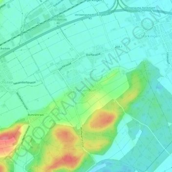
Name: Neuendorf topographic map, elevation, terrain.
Location: Neuendorf, Bezirk Gäu, Amtei Thal-Gäu, Solothurn, 4623, Schweiz (47.27994 7.77900 47.31407 7.82246)
Average elevation: 446 m
Minimum elevation: 425 m
Maximum elevation: 507 m