
Παιδί topographic map
Interactive map
Click on the map to display elevation.
About this map
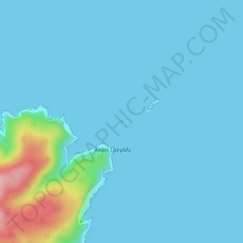
Name: Παιδί topographic map, elevation, terrain.
Average elevation: 19 m
Minimum elevation: 0 m
Maximum elevation: 178 m
Other topographic maps
Click on a map to view its topography, its elevation and its terrain.
Mitikas
Greece > Thessaly and Central Greece
Mitikas, Skiathos Municipality, Sporades Regional Unit, Thessaly, Thessaly and Central Greece, 37002, Greece
Average elevation: 261 m