
Thank you for supporting this site ❤️
Make a donation
Make a donation
Ouarzazate topographic map
Click on the map to display elevation.
Thank you for supporting this site ❤️
Make a donation
Make a donation
Ouarzazate
Ouarzazate is at an elevation of 1,151 metres (3,776 ft) in the middle of a bare plateau south of the High Atlas Mountains, with a desert to the city's south.
Thank you for supporting this site ❤️
Make a donation
Make a donation
About this map
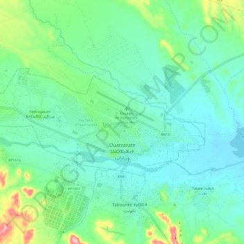
Name: Ouarzazate topographic map, elevation, terrain.
Average elevation: 1,144 m
Minimum elevation: 1,101 m
Maximum elevation: 1,289 m
Thank you for supporting this site ❤️
Make a donation
Make a donation