
Saket Tehsil topographic map
Interactive map
Click on the map to display elevation.
About this map
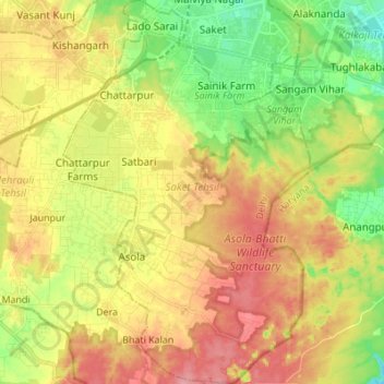
Name: Saket Tehsil topographic map, elevation, terrain.
Location: Saket Tehsil, South Delhi, Delhi, India (28.41336 77.16026 28.53350 77.24836)
Average elevation: 261 m
Minimum elevation: 211 m
Maximum elevation: 310 m
Other topographic maps
Click on a map to view its topography, its elevation and its terrain.