
Crainfeld topographic map
Interactive map
Click on the map to display elevation.
About this map
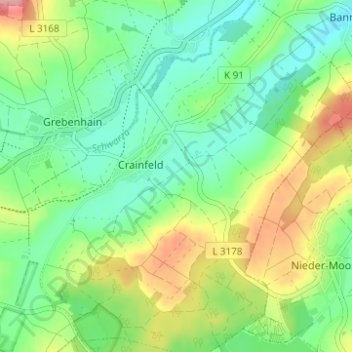
Name: Crainfeld topographic map, elevation, terrain.
Location: Crainfeld, Grebenhain, Vogelsbergkreis, Hessen, Deutschland (50.46424 9.32996 50.50357 9.38885)
Average elevation: 454 m
Minimum elevation: 413 m
Maximum elevation: 530 m
Other topographic maps
Click on a map to view its topography, its elevation and its terrain.
Ilbeshausen
Deutschland > Hessen > Vogelsbergkreis > Grebenhain > Ilbeshausen
Ilbeshausen, Grebenhain, Vogelsbergkreis, Hessen, 36355, Deutschland
Average elevation: 478 m