
Niedergründau topographic map
Interactive map
Click on the map to display elevation.
About this map
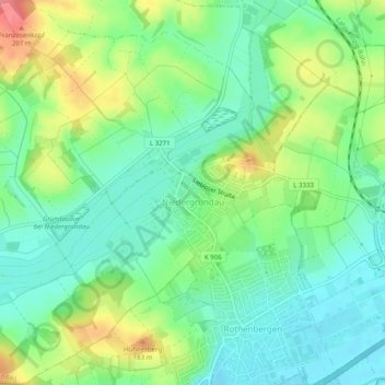
Name: Niedergründau topographic map, elevation, terrain.
Location: Niedergründau, Gründau, Main-Kinzig-Kreis, Hessen, Deutschland (50.19472 9.07151 50.22644 9.11702)
Average elevation: 151 m
Minimum elevation: 122 m
Maximum elevation: 205 m
Other topographic maps
Click on a map to view its topography, its elevation and its terrain.
Erlensee
Deutschland > Hessen > Main-Kinzig-Kreis
Erlensee, Main-Kinzig-Kreis, Hessen, 63526, Deutschland
Average elevation: 118 m