
Peasemore topographic map
Click on the map to display elevation.
About this map
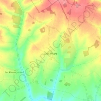
Name: Peasemore topographic map, elevation, terrain.
Location: Peasemore, West Berkshire, England, United Kingdom (51.47162 -1.36695 51.51762 -1.32369)
Average elevation: 155 m
Minimum elevation: 111 m
Maximum elevation: 200 m
Other topographic maps
Click on a map to view its topography, its elevation and its terrain.