
Rhenen topographic map
Interactive map
Click on the map to display elevation.
About this map
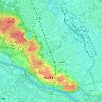
Name: Rhenen topographic map, elevation, terrain.
Location: Rhenen, Utrecht, Pays-Bas (51.94312 5.50789 52.01852 5.62731)
Average elevation: 14 m
Minimum elevation: 1 m
Maximum elevation: 61 m