
Austin topographic map
Interactive map
Click on the map to display elevation.
About this map
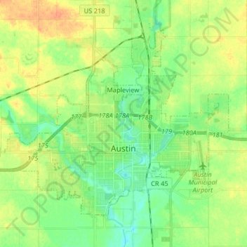
Name: Austin topographic map, elevation, terrain.
Location: Austin, Mower County, Minnesota, 55912, United States (43.64170 -93.04923 43.71334 -92.91901)
Average elevation: 374 m
Minimum elevation: 359 m
Maximum elevation: 393 m
According to the U.S. Census Bureau, Austin has a total area of 13.39 square miles (34.68 km2), of which 13.29 square miles (34.42 km2) are land and 0.11 square miles (0.28 km2), or 0.79%, are water. Its elevation is approximately 1,200 ft (370 m). The Cedar River, a tributary of the Iowa River, flows southward through the east side of the city. Tributaries within the city include Turtle Creek from the west and Dobbins Creek from the east.