
Deuzeld topographic map
Interactive map
Click on the map to display elevation.
About this map
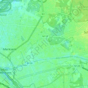
Name: Deuzeld topographic map, elevation, terrain.
Location: Deuzeld, Schoten, Antwerpen, Vlaanderen, 2170, België (51.22625 4.44460 51.26625 4.48460)
Average elevation: 6 m
Minimum elevation: 0 m
Maximum elevation: 12 m
Other topographic maps
Click on a map to view its topography, its elevation and its terrain.