
Himmelpfort topographic map
Interactive map
Click on the map to display elevation.
About this map
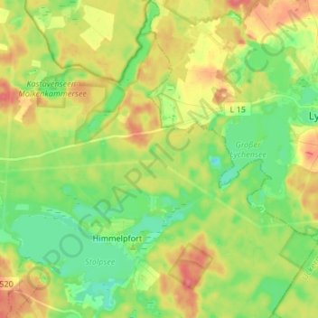
Name: Himmelpfort topographic map, elevation, terrain.
Average elevation: 66 m
Minimum elevation: 40 m
Maximum elevation: 97 m
Other topographic maps
Click on a map to view its topography, its elevation and its terrain.
Tiefenbrunn
Deutschland > Brandenburg > Oberhavel > Fürstenberg/Havel
Tiefenbrunn, Fürstenberg/Havel, Oberhavel, Brandenburg, 16789, Deutschland
Average elevation: 81 m
Großmenow
Deutschland > Brandenburg > Oberhavel > Fürstenberg/Havel > Großmenow
Großmenow, Fürstenberg/Havel, Oberhavel, Brandenburg, Deutschland
Average elevation: 69 m