
Polderstad topographic map
Interactive map
Click on the map to display elevation.
About this map
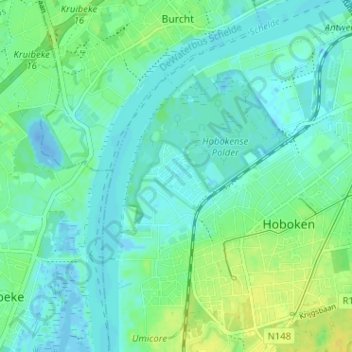
Name: Polderstad topographic map, elevation, terrain.
Location: Polderstad, Hoboken, Antwerpen, 2660, België (51.16491 4.32135 51.20491 4.36135)
Average elevation: 7 m
Minimum elevation: -24 m
Maximum elevation: 20 m
Other topographic maps
Click on a map to view its topography, its elevation and its terrain.