
Pomieri topographic map
Interactive map
Click on the map to display elevation.
About this map
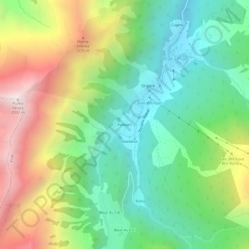
Name: Pomieri topographic map, elevation, terrain.
Location: Pomieri, Prali / Prâl, Prali, Turin, Piémont, Italie (44.85865 7.01751 44.89865 7.05751)
Average elevation: 2,007 m
Minimum elevation: 1,431 m
Maximum elevation: 2,982 m
Other topographic maps
Click on a map to view its topography, its elevation and its terrain.