
江北区 topographic map
Interactive map
Click on the map to display elevation.
About this map
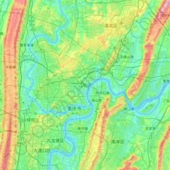
Name: 江北区 topographic map, elevation, terrain.
Location: 江北区, Chongqing, 400021, China (29.44908 106.41135 29.76908 106.73135)
Average elevation: 321 m
Minimum elevation: 149 m
Maximum elevation: 807 m
Other topographic maps
Click on a map to view its topography, its elevation and its terrain.