
Belvedere Langhe topographic map
Interactive map
Click on the map to display elevation.
About this map
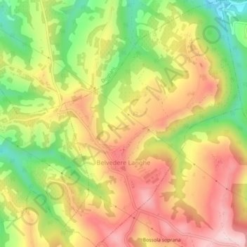
Name: Belvedere Langhe topographic map, elevation, terrain.
Location: Belvedere Langhe, Coni, Piémont, Italie (44.48251 7.96434 44.51327 7.99544)
Average elevation: 546 m
Minimum elevation: 370 m
Maximum elevation: 702 m
Other topographic maps
Click on a map to view its topography, its elevation and its terrain.