
Polaco topographic map
Interactive map
Click on the map to display elevation.
About this map
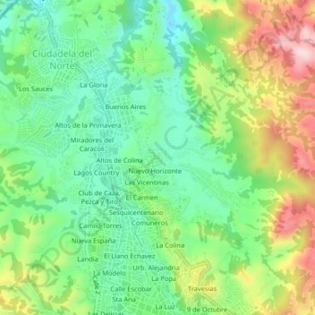
Name: Polaco topographic map, elevation, terrain.
Average elevation: 1,220 m
Minimum elevation: 1,099 m
Maximum elevation: 1,426 m
Other topographic maps
Click on a map to view its topography, its elevation and its terrain.
Las Vicentinas
Colombia > Norte de Santander > Ocaña > Ocaña
Las Vicentinas, Ocaña, Occidente, Norte de Santander, RAP Gran Santander, 546551, Colombia
Average elevation: 1,217 m