
红河哈尼族彝族自治州 topographic map
Interactive map
Click on the map to display elevation.
About this map
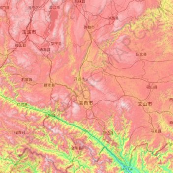
Name: 红河哈尼族彝族自治州 topographic map, elevation, terrain.
Location: 红河哈尼族彝族自治州, Yunnan, China (22.44262 101.79847 24.76837 104.27937)
Average elevation: 1,502 m
Minimum elevation: 83 m
Maximum elevation: 3,010 m
Other topographic maps
Click on a map to view its topography, its elevation and its terrain.
Prefeitura autônoma dai de Xishuangbanna
Prefeitura autônoma dai de Xishuangbanna, Yunnan, 666100, China
Average elevation: 1,093 m