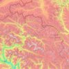
Sost topographic map
Click on the map to display elevation.
Sost
Sust or Sost (Urdu: سوست) is a village located in the Gojal, Upper Hunza in the Gilgit–Baltistan region of Pakistan. Situated at an elevation of 2,800 meters above sea level, Sost is the last Pakistani town on the Karakoram Highway before the Chinese border.
About this map

Name: Sost topographic map, elevation, terrain.
Average elevation: 3,369 m
Minimum elevation: 2,741 m
Maximum elevation: 4,897 m
Other topographic maps
Click on a map to view its topography, its elevation and its terrain.