
Souamaâ topographic map
Interactive map
Click on the map to display elevation.
About this map
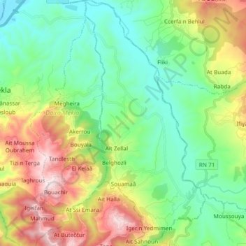
Name: Souamaâ topographic map, elevation, terrain.
Location: Souamaâ, Daïra Mekla, Tizi Ouzou, RADP (36.61237 4.31873 36.73116 4.39160)
Average elevation: 408 m
Minimum elevation: 105 m
Maximum elevation: 1,032 m