
Büddenstedt topographic map
Interactive map
Click on the map to display elevation.
About this map
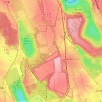
Name: Büddenstedt topographic map, elevation, terrain.
Average elevation: 125 m
Minimum elevation: 43 m
Maximum elevation: 168 m
Other topographic maps
Click on a map to view its topography, its elevation and its terrain.
Barmke
Deutschland > Niedersachsen > Landkreis Helmstedt > Helmstedt
Barmke, Helmstedt, Landkreis Helmstedt, Niedersachsen, 38376, Deutschland
Average elevation: 119 m