
Thank you for supporting this site ❤️
Make a donation
Make a donation
Bad Godesberg topographic map
Click on the map to display elevation.
Thank you for supporting this site ❤️
Make a donation
Make a donation
About this map
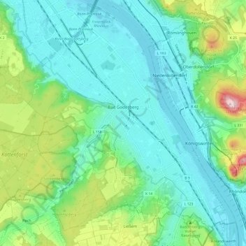
Name: Bad Godesberg topographic map, elevation, terrain.
Location: Bad Godesberg, Bonn, North Rhine-Westphalia, Germany (50.64249 7.10536 50.71772 7.21068)
Average elevation: 118 m
Minimum elevation: 48 m
Maximum elevation: 335 m
Thank you for supporting this site ❤️
Make a donation
Make a donation
Other topographic maps
Click on a map to view its topography, its elevation and its terrain.