
Thank you for supporting this site ❤️
Make a donation
Make a donation
Vale Perkins topographic map
Click on the map to display elevation.
Thank you for supporting this site ❤️
Make a donation
Make a donation
About this map
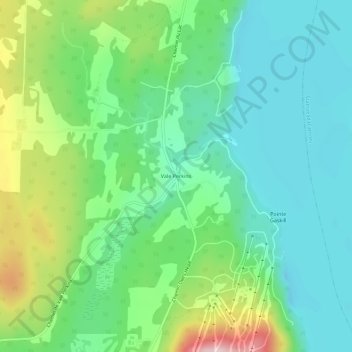
Name: Vale Perkins topographic map, elevation, terrain.
Location: Vale Perkins, Potton, Memphrémagog, Estrie, Quebec, Canada (45.06822 -72.32401 45.10822 -72.28401)
Average elevation: 287 m
Minimum elevation: 191 m
Maximum elevation: 522 m
Thank you for supporting this site ❤️
Make a donation
Make a donation