
Sidi Merouane topographic map
Interactive map
Click on the map to display elevation.
About this map
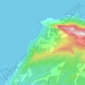
Name: Sidi Merouane topographic map, elevation, terrain.
Location: Sidi Merouane, Daïra Ténès, Chlef, 02006, RADP (36.51968 1.32003 36.55968 1.36003)
Average elevation: 119 m
Minimum elevation: -2 m
Maximum elevation: 598 m