
eMaXesibeni (Mount Ayliff) topographic map
Interactive map
Click on the map to display elevation.
About this map
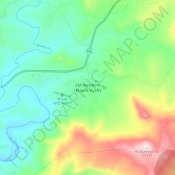
Name: eMaXesibeni (Mount Ayliff) topographic map, elevation, terrain.
Average elevation: 1,128 m
Minimum elevation: 846 m
Maximum elevation: 1,739 m
Other topographic maps
Click on a map to view its topography, its elevation and its terrain.
Tina River
South Africa > Eastern Cape > Alfred Nzo District Municipality > Umzimvubu Local Municipality
Tina River, Umzimvubu Local Municipality, Alfred Nzo District Municipality, Eastern Cape, South Africa
Average elevation: 975 m