
Ha Khoalipane topographic map
Interactive map
Click on the map to display elevation.
About this map
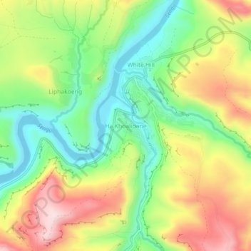
Name: Ha Khoalipane topographic map, elevation, terrain.
Location: Ha Khoalipane, Qacha's Nek District, Lesotho (-30.08552 28.45527 -30.04552 28.49527)
Average elevation: 1,710 m
Minimum elevation: 1,559 m
Maximum elevation: 1,904 m