
Tazgait topographic map
Interactive map
Click on the map to display elevation.
About this map
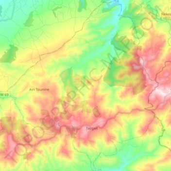
Name: Tazgait topographic map, elevation, terrain.
Location: Tazgait, Sidi Ali District, Mostaganem, Algeria (36.06136 0.46148 36.19330 0.61375)
Average elevation: 319 m
Minimum elevation: 91 m
Maximum elevation: 596 m