
Les Taillères topographic map
Interactive map
Click on the map to display elevation.
About this map
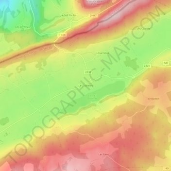
Name: Les Taillères topographic map, elevation, terrain.
Location: Les Taillères, La Brévine, Neuchâtel, 2406, Suisse (46.94961 6.55182 46.98961 6.59182)
Average elevation: 1,100 m
Minimum elevation: 890 m
Maximum elevation: 1,263 m
Other topographic maps
Click on a map to view its topography, its elevation and its terrain.
Le Baillod
Suisse > Neuchâtel > La Brévine
Le Baillod, La Brévine, Neuchâtel, 2406, Suisse
Average elevation: 1,119 m