
Mont Cervin topographic map
Interactive map
Click on the map to display elevation.
About this map
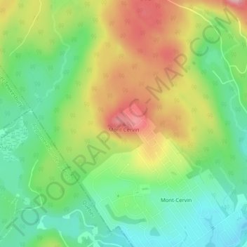
Name: Mont Cervin topographic map, elevation, terrain.
Average elevation: 263 m
Minimum elevation: 198 m
Maximum elevation: 353 m
Other topographic maps
Click on a map to view its topography, its elevation and its terrain.
Mont Tourbillon
Canada > Québec > La Jacques-Cartier > Lac-Beauport
Mont Tourbillon, Lac-Beauport, La Jacques-Cartier, Capitale-Nationale, Québec, G3B 1B3, Canada
Average elevation: 429 m