
Milos topographic map
Click on the map to display elevation.
About this map
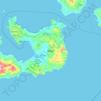
Name: Milos topographic map, elevation, terrain.
Location: Milos, Milos Regional Unit, South Aegean, Aegean, Greece (36.64473 24.31725 36.77396 24.54772)
Average elevation: 24 m
Minimum elevation: -1 m
Maximum elevation: 391 m
Other topographic maps
Click on a map to view its topography, its elevation and its terrain.