
Thank you for supporting this site ❤️
Make a donation
Make a donation
Kakunyu topographic map
Click on the map to display elevation.
Thank you for supporting this site ❤️
Make a donation
Make a donation
About this map
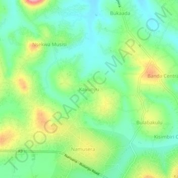
Name: Kakunyu topographic map, elevation, terrain.
Location: Kakunyu, Wakiso, Central Region, Uganda (0.40735 32.44439 0.44735 32.48439)
Average elevation: 1,182 m
Minimum elevation: 1,135 m
Maximum elevation: 1,268 m
Thank you for supporting this site ❤️
Make a donation
Make a donation
Other topographic maps
Click on a map to view its topography, its elevation and its terrain.