
Thank you for supporting this site ❤️
Make a donation
Make a donation
Hatley Mountain topographic map
Click on the map to display elevation.
Thank you for supporting this site ❤️
Make a donation
Make a donation
About this map
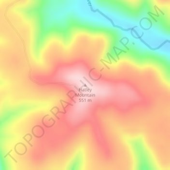
Name: Hatley Mountain topographic map, elevation, terrain.
Location: Hatley Mountain, Van Buren County, Arkansas, United States (35.56058 -92.76938 35.56068 -92.76928)
Average elevation: 445 m
Minimum elevation: 293 m
Maximum elevation: 551 m
Thank you for supporting this site ❤️
Make a donation
Make a donation