
Thank you for supporting this site ❤️
Make a donation
Make a donation
Hohenegg topographic map
Click on the map to display elevation.
Thank you for supporting this site ❤️
Make a donation
Make a donation
About this map
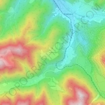
Name: Hohenegg topographic map, elevation, terrain.
Location: Hohenegg, Eisenerz, Bezirk Leoben, Styria, 8790, Austria (47.50745 14.85668 47.54745 14.89668)
Average elevation: 987 m
Minimum elevation: 687 m
Maximum elevation: 1,436 m
Thank you for supporting this site ❤️
Make a donation
Make a donation