
Thank you for supporting this site ❤️
Make a donation
Make a donation
Seine topographic map
Click on the map to display elevation.
Thank you for supporting this site ❤️
Make a donation
Make a donation
About this map
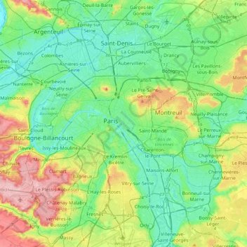
Name: Seine topographic map, elevation, terrain.
Location: Seine, Paris, Île-de-France, France métropolitaine, France (48.72748 2.16930 48.97406 2.56552)
Average elevation: 69 m
Minimum elevation: 22 m
Maximum elevation: 187 m
Thank you for supporting this site ❤️
Make a donation
Make a donation
Other topographic maps
Click on a map to view its topography, its elevation and its terrain.