
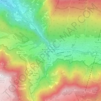
Runcadic - Runggaditsch - Roncadizza topographic map
Interactive map
Click on the map to display elevation.
About this map
Name: Runcadic - Runggaditsch - Roncadizza topographic map, elevation, terrain.
Average elevation: 1,520 m
Minimum elevation: 952 m
Maximum elevation: 2,167 m
Other topographic maps
Click on a map to view its topography, its elevation and its terrain.
Compatsch
Italie > Trentin-Haut-Adige > Haut-Adige > Kastelruth - Castelrotto
Compatsch, Kastelruth - Castelrotto, Salten-Schlern - Salto-Sciliar, Haut-Adige, Trentin-Haut-Adige, Italie
Average elevation: 1,859 m