
Lac Geneviève topographic map
Interactive map
Click on the map to display elevation.
About this map
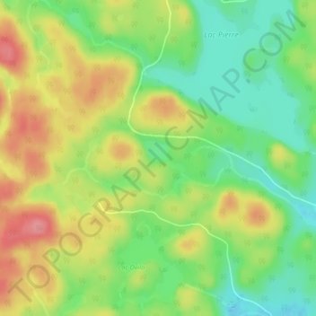
Name: Lac Geneviève topographic map, elevation, terrain.
Average elevation: 729 m
Minimum elevation: 686 m
Maximum elevation: 780 m
Other topographic maps
Click on a map to view its topography, its elevation and its terrain.
Lac Pee-Wee
Canada > Québec > Le Fjord-du-Saguenay > Mont-Valin
Lac Pee-Wee, Mont-Valin, Le Fjord-du-Saguenay, Saguenay–Lac-Saint-Jean, Québec, Canada
Average elevation: 653 m